The Best Hiking GPS Devices
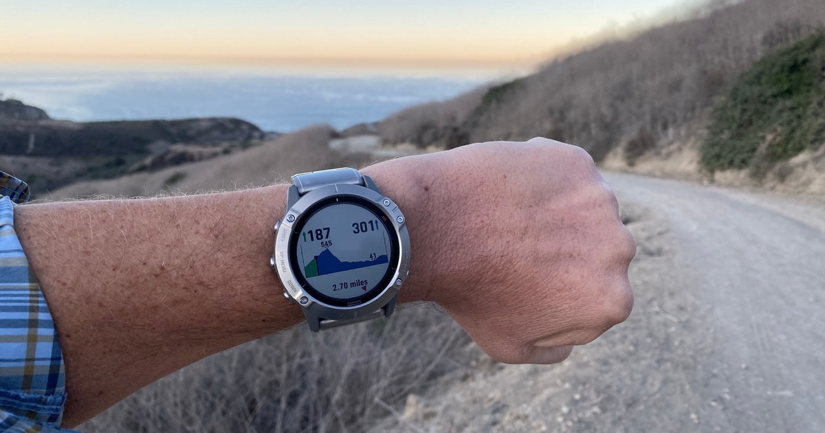
A hiking GPS earns its place in your pack on the days your phone can't help. Cold drains a phone battery fast. Rain turns a touchscreen into a smudge. And past the last cell tower, your mapping app quietly stops updating anything. A dedicated handheld runs for days, shrugs off being dropped on granite, and on the better models it can push a text or an SOS through a satellite. That's the whole pitch, and for backcountry travel it still holds up.
No device here is a clean win. The ones that can call for help need a subscription, so the real cost keeps arriving every month you leave the plan active. Screens are small and slow next to the phone in your pocket. Planning a route on a two-inch display is genuinely tedious, so you'll do most of it at home in an app and sync it over. And none of them replace knowing how to read a paper map. Treat any of these as a backup brain, not a substitute for one.
So the question isn't which unit has the longest feature list. It's how much weight you'll carry, whether you need two-way messaging, and how far you get from a wall outlet. We looked at handhelds, wrist units, a watch, and pure satellite messengers, because most people shopping here are really choosing between those shapes. We think that the Garmin GPSMAP 67i is the best hiking GPS device for most people, and that the Garmin inReach Mini 2 is the one to buy if you count every ounce.
Everything we recommend

Real maps, real messaging, and a screen you can read at noon

A satellite lifeline light enough to forget you packed

Plain navigation, AA batteries, and nothing to subscribe to

A five-inch touchscreen you can work with gloves on

Maps and training data on your wrist, topped up by sunlight
Prices as of Oct 25, 6:48 AM PT · Details
At a glance
| Product | Screen | Satellite SOS | Price | |
|---|---|---|---|---|
| Garmin GPSMAP 67i Rugged GPS Handheld withTop pick | 3-inch color | — | $459.99 |
| Garmin inReach® Mini 2Runner-up | — | — | $299 |
| Garmin eTrex® SEBudget pick | 2.2-inch | — | $149.99 |
| Garmin Montana® 760iUpgrade pick | 5-inch touchscreen | — | $849.99 |
 | Garmin Foretrex 801Also consider | Monochromatic | — | $249.99 |
 | Spot Gen 4 Satellite GPS MessengerAlso in lineup | — | — | Check price |
 | ZOLEO Satellite CommunicatorAlso consider | — | — | Check price |
| Garmin fēnix® 8 Solar SapphireAlso great | 1.3-inch solar | — | $983.39 |
Prices as of Oct 25, 6:48 AM PT · Details
How we picked
Accuracy in hard terrain. We compared receiver specs and published reviews to see which units hold a fix under canopy and in canyons. Multi-band reception moved a device up; single-band was acceptable only on the budget end.
Messaging and SOS. We favored two-way satellite communication over one-way beacons, because rescuers can confirm what's wrong before dispatch. We noted which network each device uses and whether SOS routes to a staffed response center.
Battery and power type. We read manufacturer runtime ratings for tracking, expedition, and power-save modes. Field-replaceable AAs and solar top-ups both counted, since neither one helps you if you can't reach an outlet for days.
Screen and controls. We looked for sunlight-readable displays and controls you can work with gloves on. Button-driven units scored well for cold and technical terrain; big touchscreens had to earn their weight.
Subscription commitment. For anything satellite-connected, we weighed how flexible the plans are, including pay-per-use tiers and seasonal suspension. Ongoing plan cost is part of owning the device, not an afterthought.
Top pick
Real maps, real messaging, and a screen you can read at noon
Garmin GPSMAP 67i Rugged GPS Handheld with
The GPSMAP 67i is a rugged handheld with preloaded TopoActive maps, multi-band satellite reception, and built-in inReach two-way messaging. You get real navigation and a way to call for help from the same three-inch screen, without pulling out your phone or clipping on a second device.
$459.99fromAmazonPrices as of Oct 25, 6:48 AM PT · Details
This is the one device that does both jobs well. Most units here either navigate or send messages. The 67i does both, so you're not hanging a messenger off one shoulder strap and a handheld off the other. You can watch your position crawl across a topo map, drop a waypoint at a water source, and text your ride about a late finish, all from the same set of buttons. On a multi-day trip, that consolidation matters more than any single spec.
Multi-band reception is the quiet upgrade. Older single-band units wander under thick fir canopy or down a slot canyon, and your track log turns into spaghetti. The 67i pulls GPS, GLONASS, and Galileo across two frequency bands, and RTINGS reported that it held a position lock in dense tree cover where single-band handhelds dropped out. If you plan to follow your own breadcrumbs back in the dark, that accuracy is the difference between a clean line and a guess.
The screen is three inches, which sounds tiny next to a phone. It's also sunlight-readable, which your phone isn't, and it takes button presses instead of taps, which is what you want with wet gloves on. The whole layout is built around a thumb rather than a fingertip. You give up some map real estate and get back the ability to actually use the thing in weather.
Storage is generous enough that you can stop curating maps. Garmin lists 16GB onboard plus a microSD slot, which is room for TopoActive coverage of North America and Europe at once, with satellite imagery on top if you want it. Load the region before you leave and you're done thinking about it. Trip planning happens in the Garmin Explore app or website and syncs over, which beats nudging a cursor around on the device itself.
Flaws but not dealbreakers
The listing here is a Renewed unit, so it's been refurbished rather than sold new in a sealed box. Light cosmetic wear is normal on renewed gear. Check the return window and confirm the device powers up and locks a fix in your driveway before you take it somewhere that matters.
It's also the bulky choice. At about half a pound it rides fine in a hip-belt pocket, but you'll feel it against a three-and-a-half-ounce messenger. And the satellite half is dead weight without an active plan. The maps and GPS keep working, but messaging and SOS simply don't.
Runner-up
A satellite lifeline light enough to forget you packed
Garmin inReach® Mini 2
The inReach Mini 2 is a palm-sized satellite communicator with two-way texting, interactive SOS, and TracBack routing to retrace your steps. Garmin lists it at 3.5 ounces, so it clips to a shoulder strap and disappears until the moment you actually need it.
$299fromAmazonPrices as of Oct 25, 6:48 AM PT · Details
Three and a half ounces is the number that sells this thing. That's roughly a third of what the 67i weighs, light enough that thru-hikers who weigh their toothbrush still carry one. It clips to a strap where it can see sky, which is where a satellite device belongs anyway. If your rule is that safety gear only comes along when you can't feel it, this clears the bar easily.
Two-way messaging is the feature worth paying for. A one-way beacon tells rescuers something is wrong somewhere. Two-way lets them ask what happened and lets you answer. OutdoorGearLab has made the same point in its comparisons: confirming the nature of an emergency before dispatch cuts a lot of confusion out of a rescue. Backpacker Magazine reported message round trips of under two minutes with open sky overhead. Under heavy canopy, expect to wait longer.
Navigation is deliberately basic. There's a digital compass that gives you an accurate heading while you're standing still, and TracBack walks you back along the line you came in on. That's about it. There's no topo map on the device and no screen worth staring at. Pair it with the Explore app and your phone becomes the map while the Mini 2 handles the sky.
It also works as a radio for gear you already own. Garmin lists pairing with its watches and handhelds, so you can read messages and trigger an SOS from your wrist while the Mini 2 stays clipped and aimed upward. If you're already deep in the Garmin ecosystem, that's a tidy setup and one less thing to fish out of a pocket.
Flaws but not dealbreakers
Typing on the device is miserable. It's a few buttons and a character wheel, so most people compose on their phone through the app and let the Mini 2 do the sending. That works right up until your phone is dead or too cold to wake up, which is exactly when you'd want to send something.
It also does nothing useful without a plan. No subscription means no messages and no SOS, and plans bill on a schedule whether you hike that month or not. Some tiers let you suspend during the off season. Sort that out before you commit, not after.
Budget pick
Plain navigation, AA batteries, and nothing to subscribe to
Garmin eTrex® SE
The eTrex SE is a small button-driven handheld that tracks across GPS, GLONASS, Galileo, BeiDou, and QZSS, running on two AA batteries. There's no satellite messaging, so there's no monthly plan either. It points you home and that's the job.
$149.99fromAmazonPrices as of Oct 25, 6:48 AM PT · Details
The battery story is the reason to buy it. Garmin rates up to 168 hours in standard mode and up to 1,800 hours in expedition mode on two AAs. Field-replaceable power matters on long trips, because you can buy AAs in a trail-town gas station and swap them with numb fingers at ten below. Carry a spare pair and your navigation just doesn't run out on you.
Reception is better than you'd expect from an entry-level unit. Five satellite systems means it keeps a usable fix in canyons and under canopy where a bare GPS-only receiver stumbles around. It's single-band, so it won't match the 67i when the sky is a narrow strip overhead. For trail walking, hunting in mixed timber, and finding your way back to a trailhead, it's plenty.
The 2.2-inch display is small and readable in bright sun, and everything runs off buttons, so gloves are fine. Garmin points you to the Explore app for trip planning, weather, notifications, and extra mapping, which means your phone does the heavy lifting at camp while the eTrex does the walking. Geocachers get live cache descriptions, logs, and hints through the same pairing.
It's also the least intimidating unit here. If your last GPS was bolted to a car dashboard, you can learn this one on the drive to the trailhead. Owners who mainly want a heading, a few waypoints, and a track back to the truck tend to be happy. The ones who aren't usually wanted detailed maps it was never going to have.
Flaws but not dealbreakers
There's no satellite messaging and no SOS. If you hike alone past cell coverage, this isn't your safety net, and no amount of battery life changes that. Pair it with a messenger or buy a device with satellite built in. That's the trade you make for having no monthly plan.
Mapping is thin out of the box. You get a clear sense of where you are, not the shaded topo detail the 67i loads, and better maps arrive through the app rather than preloaded. Owner feedback also runs more mixed here than on the Mini 2, mostly about fiddly menus and occasional pairing hiccups rather than the navigation itself.
Upgrade pick
A five-inch touchscreen you can work with gloves on
Garmin Montana® 760i
The Montana 760i is a big-screen handheld with inReach satellite messaging, an 8-megapixel geotagging camera, and TopoActive plus City Navigator maps. It's rated to MIL-STD 810 and IPX7, and it's as happy on a dashboard mount as it is in your hand.
$849.99fromAmazonPrices as of Oct 25, 6:48 AM PT · Details
The screen is the whole point. Five inches of glove-friendly touchscreen makes planning on the device tolerable instead of maddening. You can take in a whole drainage at once, pan without hunting a cursor across the map, and read it from a mount at arm's length. If you drive to the edge of the road and then walk from there, this is the unit that works in both places.
The built-in camera is more useful than it sounds. Eight megapixels won't replace your phone, but every shot gets tagged with its location, so a photo of a junction, a gate, or a good camp becomes a waypoint you can navigate back to. Overlanders use it for exactly that: marking a faint turnoff you'd never find again from memory alone.
Satellite coverage is the same inReach setup as our top pick. You get two-way texting, tracking over the Iridium network, and interactive SOS to Garmin's staffed response team, all gated behind an active subscription. Maps go broader here too, with TopoActive for trails and City Navigator for pavement, plus room to add marine charts if your trip ends at a boat ramp.
It's the heaviest and most expensive unit here, and that's deliberate. Garmin lists it at about fourteen and a half ounces, roughly three times an inReach Mini 2. Nobody is thru-hiking with this. But for a truck, a side-by-side, or a base camp where one device serves the whole group, the weight buys you a screen and a battery a wrist unit can't touch.
Flaws but not dealbreakers
The touchscreen is the weak spot in bad weather. Wet glass picks up stray taps, and thick gloves are less precise than buttons no matter how well the panel is tuned. IPX7 means a downpour won't kill it, but you'll end up drying the screen on your sleeve more often than you'd like.
It's also far more device than a day hiker needs. If your trips run half a day on marked trail, you're carrying a screen and a camera you won't use, and mounts are sold separately, so the setup you actually want costs more than the box does.
Also great
Maps and training data on your wrist, topped up by sunlight
Garmin fēnix® 8 Solar Sapphire
The fēnix 8 Solar Sapphire is a titanium GPS watch with a 1.3-inch solar-charged display, a scratch-resistant sapphire lens, and a built-in flashlight. Garmin rates it at up to 92 hours in GPS mode with solar charging and up to 28 days in smartwatch mode.
$983.39fromAmazonPrices as of Oct 25, 6:48 AM PT · Details
The appeal is not carrying anything extra. It's already on your wrist, so you glance at your route instead of stopping, dropping a pack, and digging out a handheld. For trail runners and fast-and-light days, that's the difference between checking navigation often and never checking it at all. The titanium bezel and sapphire lens handle rock scrapes better than ordinary watch glass.
Solar charging changes the math on long trips. Garmin's runtime numbers assume bright conditions, and DC Rainmaker has reported meaningfully longer GPS-mode life on the solar version under direct sun. On an alpine day above treeline, the watch tops itself up while you walk. Under forest canopy or in flat winter light, plan on the non-solar figures and bring a cable for camp.
It handles the rest of your life too. There's multi-band GPS, offline topo maps, a flashlight that's genuinely useful for a pre-dawn start, a speaker and mic for calls through your phone, and readiness scores built from sleep and recovery data. Off-grid voice commands work without a phone nearby. If you were buying a watch anyway, this collapses two purchases into one.
But a 1.3-inch screen is still a 1.3-inch screen. Reading a topo map means zooming and panning on a small circle, and any real route planning happens on your phone and syncs over. For following a course you already built, it's fine. For working out where you are in unfamiliar terrain, a handheld wins and it isn't close.
Flaws but not dealbreakers
There's no satellite messaging. Garmin's watches can pair with an inReach and act as a remote for it, but the watch alone can't reach a satellite, so this isn't a safety device on its own.
It's also the most complicated thing here. Owner feedback on the newest fēnix generation runs hotter and colder than on Garmin's simpler handhelds, and the complaints usually land on software behavior rather than the hardware. If you want a device that does one job the same way every single time, buy a handheld instead.
Who this is for
Buy one of these if you regularly walk past cell coverage, hike alone, or travel somewhere a wrong turn gets expensive. Backpackers, hunters, overlanders, and anyone doing multi-day trips get the most out of a dedicated unit, mostly because it outlasts a phone and keeps working when the weather turns. If you also want the ability to call for help, you want a satellite device specifically, and you want to accept the subscription that comes with it.
Skip all of this if your hiking is a few marked miles on well-traveled trail with bars on your phone the whole way. A downloaded map and a battery pack cover that fine. This guide covers handheld GPS units, wrist-mounted navigators, satellite messengers, and one GPS watch. It doesn't cover marine or aviation navigation, car units, phone apps, or drone controllers, and it only includes products we could confirm are currently listed.
How we picked
We built the shortlist from manufacturer spec sheets, published reviews, and recurring themes in owner feedback, then weighed five things. Accuracy: multi-band reception that survives dense canopy and canyon walls, since a wandering track is worse than no track. Messaging and SOS: two-way satellite communication over one-way beacons, with SOS routed to a staffed response center. Battery: manufacturer runtime ratings in tracking and expedition modes, plus whether you can swap in AAs or catch a solar top-up. Screen and controls: sunlight readability and glove-friendly operation, because a device you can't work in a storm isn't navigation. Subscription: how flexible the plans are, including pay-per-use tiers and the option to suspend during the off season.
Other hiking gps devices worth considering
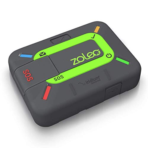
If you want the most flexible messaging plans: The ZOLEO Satellite Communicator — The ZOLEO Satellite Communicator sends two-way texts and emails over the Iridium network and automatically switches to cellular or Wi-Fi when either is available, so you're not burning satellite messages in town. It gets its own SMS number and email address, which means friends can reach you without learning a special app first. Plans include unlimited check-ins and let you pay per message rather than committing to a big monthly allowance, and there's a Medical Assist option for problems that aren't quite emergencies. The catch is that it's an app-first device with no maps and no display worth navigating from. Your phone is the screen, always.
If you want navigation on your wrist without a touchscreen: The Garmin Foretrex 801 — The Foretrex 801 straps to your wrist or a pack strap and gives you a monochrome screen that stays legible in almost any light, including through night vision goggles. Multi-band reception improves position accuracy, and the 3-axis compass, accelerometer, and barometric altimeter give you a steadier elevation reading than GPS altitude alone. There's a stealth mode that stops storing and sharing location data and a kill switch that wipes device memory, both inherited from its military-issue ancestry. What you give up is maps. This tells you where you are and where you're heading, not what the terrain looks like, and it doesn't talk to satellites for help on its own.
The competition
This is what our research surfaced, not a survey of everything sold. Plenty of capable units exist that we couldn't confirm as currently listed, and a device missing from this list isn't automatically a bad one.
The Spot Gen 4 Satellite GPS Messenger — The SPOT Gen4 is a one-way satellite messenger. Press the SOS button and it sends your GPS coordinates to emergency responders over the Globalstar network, and the tracking feature reports your location as you move and when you stop. Switchback Travel notes that SPOT's base plan runs meaningfully less per month than comparable two-way Garmin plans, which is the main reason people still buy one. It lost to the Mini 2 because you can't hold a conversation with it. Rescuers get a location and nothing else, so they can't ask whether you've broken an ankle or run out of water. If you want a simple panic button for occasional trips and you'd rather not carry a bigger plan commitment, it does that one job.
Setup and field care
Do the boring setup at home. Download the maps you'll need over Wi-Fi, update the firmware, and sync your planned route from the companion app so you're not building it with cold thumbs at a trailhead. If your device has satellite service, activate the plan a few days early and send a test check-in from outside, where it can see open sky. On the trail, mount it high on a shoulder strap or pack lid rather than burying it in a pocket, since a clear view of the sky matters more than any spec. Carry spare AAs or a small power bank depending on what the unit takes. Rinse off salt and grit, dry it before storage, and pull the batteries if it's going in a drawer for the season.
Questions we get
Are dedicated GPS devices still worth it when phones have GPS?
For day hikes with cell service, a phone is usually enough. Past that, a dedicated unit wins on battery life, cold tolerance, and durability, and it's the only thing that sends a message when there's no tower for fifty miles. Phone GPS chips are also single-band on most models, so accuracy drops in canyons and thick timber. If your phone dying would leave you genuinely stuck, carry a handheld.
What's the difference between a GPS device and a satellite messenger?
A GPS device receives satellite signals to tell you where you are and shows it on a map. A satellite messenger transmits, so it can send your position and text messages out through a satellite network. Some devices do both, like the GPSMAP 67i and the Montana 760i. A pure messenger like the inReach Mini 2 or ZOLEO handles the sky while your phone handles the map.
Do I need a subscription for an inReach to work?
Yes, for anything satellite-related. Without an active plan, the messaging and SOS features are inert, though GPS navigation and maps on a device like the 67i keep working normally. Plans are billed monthly or annually and some tiers can be suspended when you're not using them. Budget for the plan as part of owning the device, not as an extra.
Do I still need a paper map and compass?
Yes. Batteries die, screens crack, and electronics get dropped in creeks. A map and compass weigh almost nothing and don't fail. Also worth knowing: GPS-only altitude estimates can drift by more than a hundred feet, which is why REI's buying guide favors units with a barometric altimeter. Use the device for speed and the map for judgment.
Is the eTrex SE good enough for serious backpacking?
For navigation on established routes, yes, and the AA batteries are a real advantage on long trips. What it can't do is call for help, and it doesn't carry detailed topo mapping out of the box. If you're going deep and solo, pair it with a satellite messenger or move up to a device with inReach built in.
Can I use a GPS watch instead of a handheld?
You can, and for trail running or fast day hikes a watch like the fēnix 8 Solar is more convenient than anything you have to unpack. The limits are screen size and messaging. Reading a topo map on a small round display is slow, and the watch can't reach a satellite for help by itself. For long, unfamiliar backcountry routes, a handheld is still the better navigation tool.
Why you should trust us
For this guide:
- We read manufacturer spec sheets and product listings for every device here, focusing on receiver type, rated battery life, display size, and water resistance.
- We compared published reviews from outlets including RTINGS, OutdoorGearLab, DC Rainmaker, Backpacker Magazine, GearJunkie, and Switchback Travel, along with REI's buying guidance on altimeters and navigation.
- We reviewed recurring themes in owner feedback to identify common complaints about menus, pairing, and software behavior.
- We read owner reviews on every listing, weighted toward the critical ones, because that is where the recurring failures show up.
- We have a systematic way of automatically fetching the latest prices, so the numbers on this page stay current.
- This is a research-focused guide, so the team may not own every product listed — though we often do own the top winners, which gives us extra context for the recommendations.
- We don't accept free products, and the retailer commission never changes which product we recommend.
Sources
Garmin GPSMAP 67i Review, RTINGS.com
Best GPS Devices and Satellite Communicators of 2026, OutdoorGearLab
The Best Satellite Messengers and GPS Trackers, Wirecutter
Garmin inReach Mini 2 Review, Backpacker Magazine
How Satellite Communicators Work and Why You Need One, REI Co-op
Garmin eTrex SE Specifications, Garmin
Garmin Montana 900i Specifications and User Manual, Garmin
SPOT Gen4 vs Garmin inReach: Which Satellite Communicator Is Right for You?, Switchback Travel
ZOLEO Satellite Communicator Review, GearJunkie
Garmin Fenix 8 Solar In-Depth Review, DC Rainmaker
Handheld GPS Buying Guide, REI Co-op
Garmin Foretrex 801/901 Ballistic Edition Review, GPS City
Amazon product listings and owner reviews for all 8 products
Manufacturer specification pages for each product
Some passages in this guide may be paraphrased with AI help.
Product prices and availability are accurate as of the date/time indicated and are subject to change. Any price and availability information displayed on Amazon.com at the time of purchase will apply to the purchase of this product.
More like this.
Continue exploring electronics reviews and recommendations.

The Best Motorcycle GPS Navigation Devices
A phone in a handlebar clamp works right up until it doesn't. Then you're squinting at a washed-out screen in afternoon sun, or watching the map freeze…

The Best Smart Home Devices
A smart home is really just a pile of small conveniences that add up. The lights come on before you walk in the door. The thermostat stops heating an…

The Best Hiking Headlamps
The last mile of a hike almost always happens in the dark. You misjudge the daylight, or the descent takes longer than you planned, and suddenly you're…

The Best GPS Trackers for Vehicles
A GPS tracker earns its keep on ordinary days, not dramatic ones. You want to know your kid got to practice. You want to see whether the work van sat idle…

The Best GPS Navigation Systems for Cars
A dedicated car GPS does one job, and it does it without asking anything of your phone. It already has the map onboard, so it keeps calling out turns…

The Best Marine GPS Fish Finders
A fish finder earns its keep on the slow days. When nothing's biting, the screen tells you whether you're sitting over flat mud or a submerged brush pile…